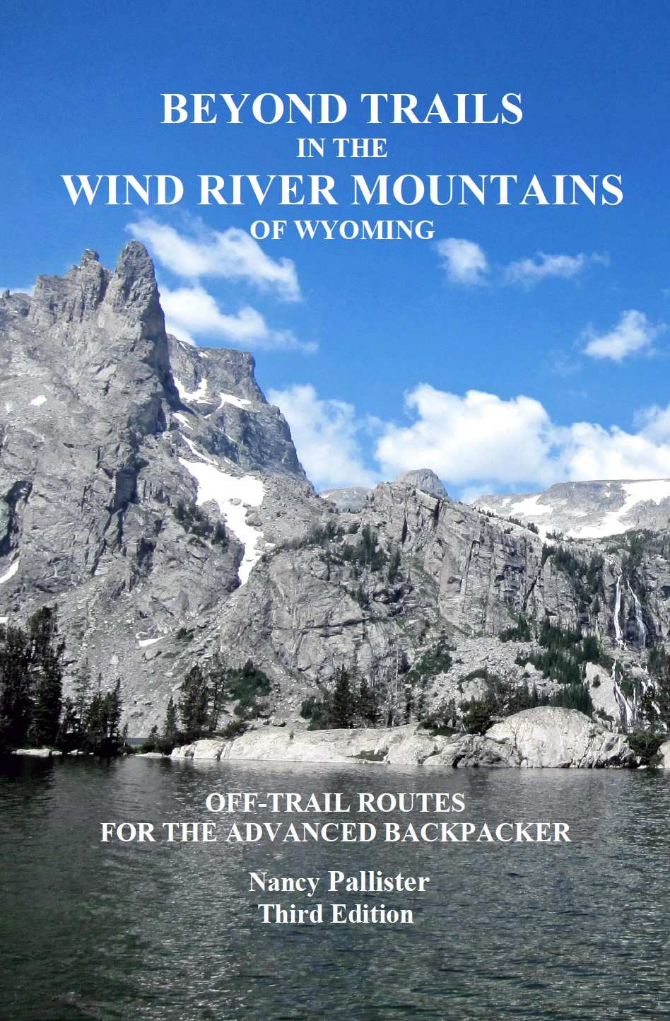
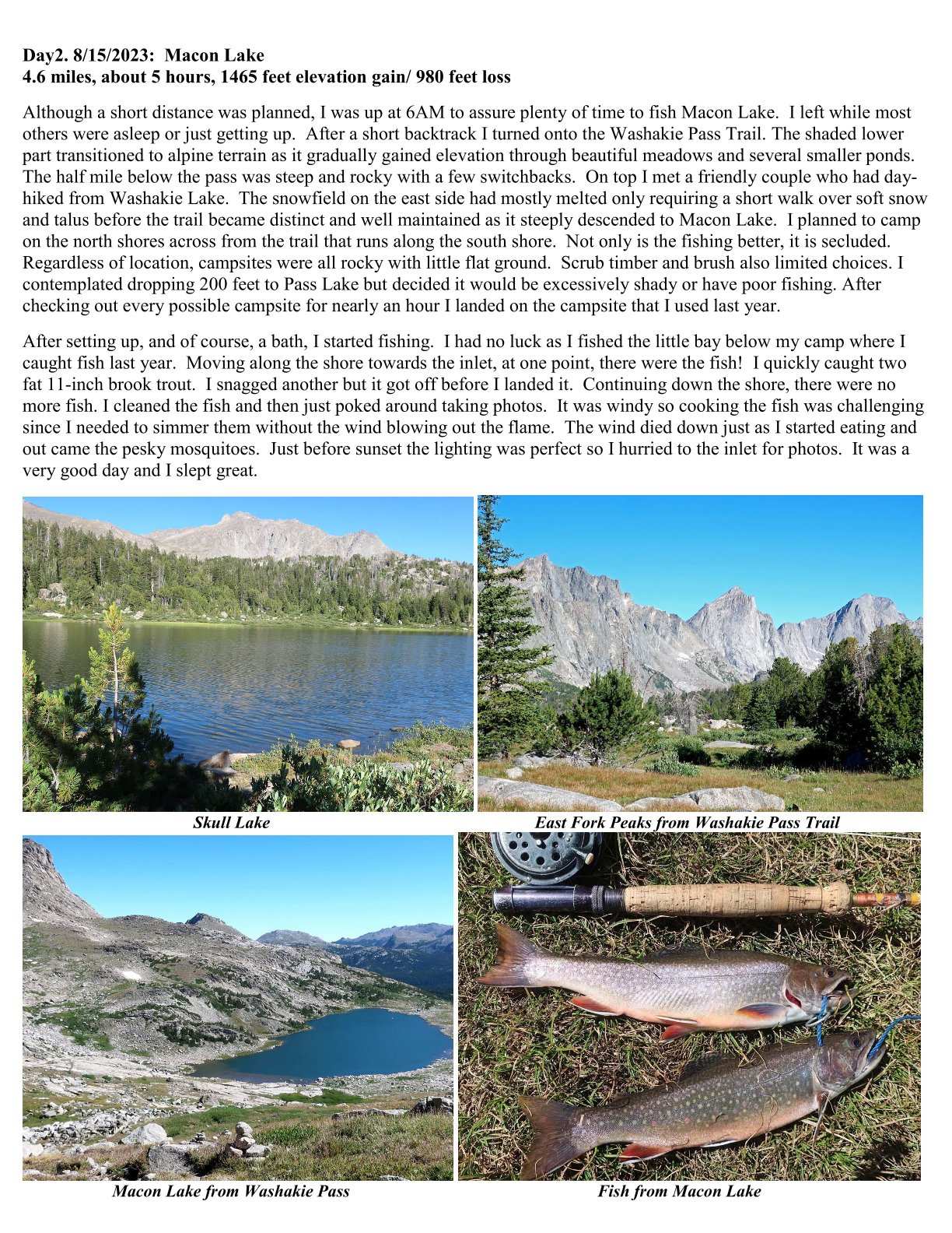
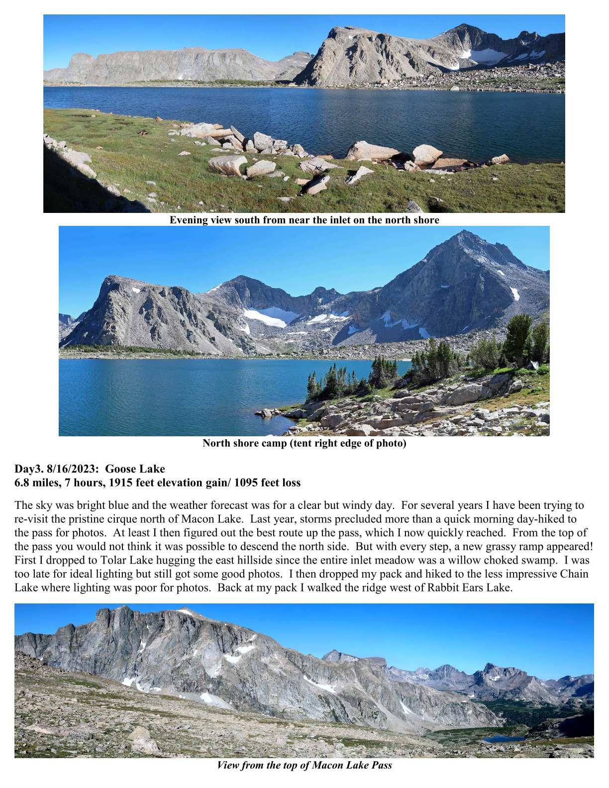
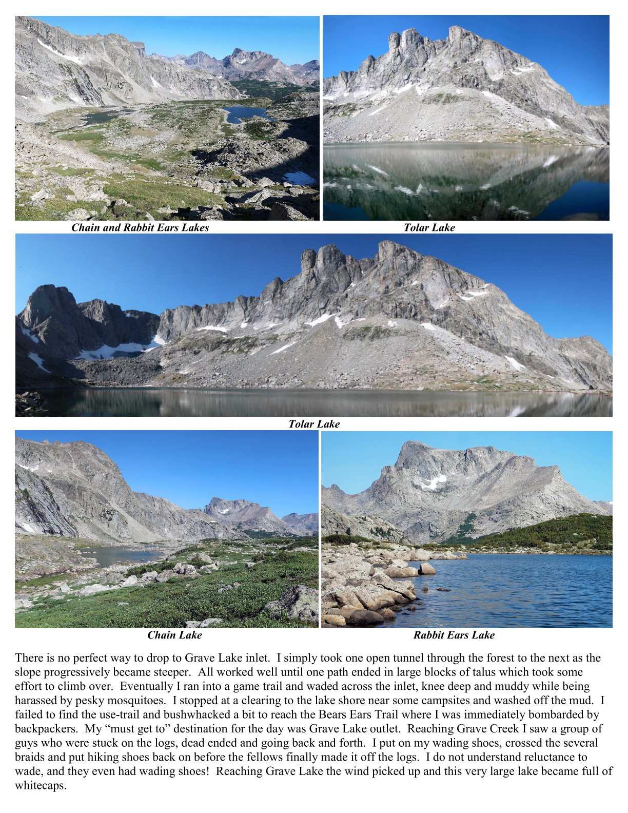
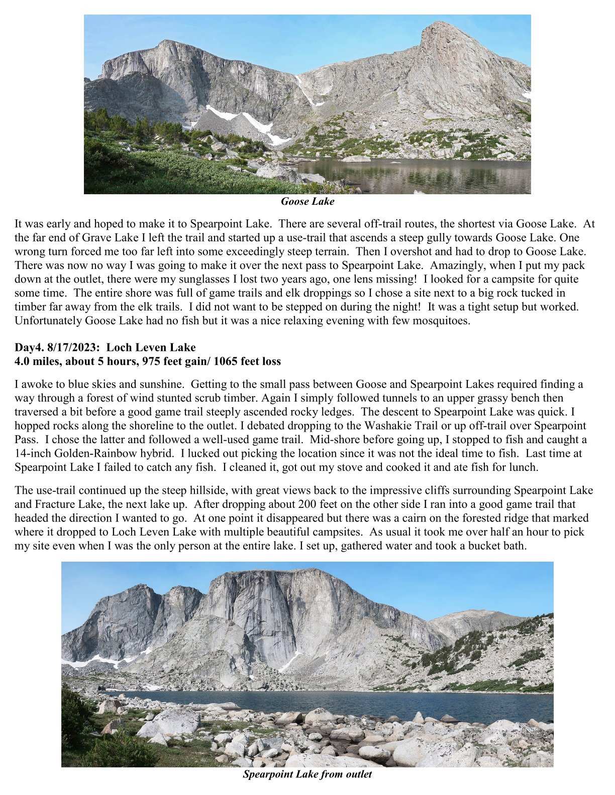
Beyond Trails in the Wind Rivers of Wyoming
Off-Trail Routes for the Advanced Backpacker
Third Edition
©2025 Nancy Pallister
Self-published
Also available at:
https://www.wildirisclimbing.com (Lander, Wyoming)
https://www.greatoutdoorshop.com (Pinedale, Wyoming)
Designed for the advanced backpacker, the 57 routes emphasize the alpine terrain along the Continental Divide with 10% to 70% off-trail travel. Route line-maps, travel plans, route profiles and day-by-day route descriptions are in the book. Virtual tours and a printable map appendix (USGS 7.5 minute) are in the included CD.
$45.00 1 Book with CD
$11.00 Shipping & handling at USPS Priority Flat Rate (revised when postal rates change)
$56.00 Total
Terms of Sales
- PayPal is the only payment option offered on this web-site
Please send the total amount shown above to me through my PayPal account: nancy@mcreynoldscpa.com
The book will be sent to the mailing address in the PayPal “comments” box
- Contact us (e-mail) for direct order and payment by personal check
- The check must clear before the book is sent
- Contact us for large volume orders
- ALL SALES ARE FINAL
Shipping
- Books will be sent USPS Flat Rate Priority
- Shipping outside of USPS (USA) delivery is limited- contact us before purchase
- USPS insurance claims are the buyer’s responsibility
- Shipping rates are subject to change
- Shipping is limited to one books per flat rate envelope or small box
- I am not responsible for slow delivery once shipped
Copy the CD onto your computer and store the CD as a back-up. Contact us if your CD is damaged or lost. Public libraries or office supply/print shops can transfer the CD contents if you do not have a CD drive. Other digital means are being considered, but not available at this time.
CD contents: The “Map Appendix” presents 79 printable maps using 7.5-minute USGS topographic maps as the base. These files are integral to the text of the book. Route descriptions specifically refer to these files. The 57 “Virtual Tours”, grouped into 7 pdf files by book chapters, show a sample of each route’s scenery. Although you could print these, they are intended simply for viewing.
This guidebook presents 57 routes in the Wind River Mountains designed for the advanced backpacker with off-trail experience. Forty-six are essentially loop routes to the same or a nearby trailhead. Eleven are stand-alone point-to-point routes that can also be used to design your own thru route. Routes vary from about 20-80 miles in length and 4 to 11 days. Off-trail travel varies from 10% to 70% of the routes. All routes require some backpacking experience, a few are suitable for the off-trail novice, most are designed for the experienced off-trail backpacker, and a few require mountaineering experience.
What makes this guidebook stand out from the others?
- Every mile on and off trails is rated for difficulty
- Foul-weather detours are described
- Detailed “travel plans” use the author’s experience to insure the highest chance of success
- Summarized route statistics and hazard statements help you choose a route within your capabilities, hazard tolerance and time limits
- No other guidebook describes as many miles on the Wind River Indian Reservation “Roadless Area”
What’s new in the Third Edition?
- Some routes were reconfigured, reversed, lengthened or shortened.
- An attempt was made to keep the same route number as in the second edition. Some have changed.
- Rather than specific “thru-routes” 11 point-to-point routes along the crest of the mountains can be stand-alone routes, or mix-and-match for a custom thru-route.
- Maps have been updated and new photos added.
- Conditions have been updated due to wildfires, wind-storm “blow-downs” and other natural events.
- Verification of current conditions is based on extensive trips in 2018, 2020, 2022 and 2023.
Example Virtual Tour
Click here to see a “Virtual Tour” selected from the guidebook.
Condition Alerts and Updates
As of September 20, 2025 the Dollar Lake wildfire has spread to the west side of Green River Lake and is about 60% contained. Contact the Bridger National Forest in Pinedale for information on access to the campground and trailhead. The Porcupine Trail, used by Route #37, may have been impacted.

Example line map, travel plan, profile
Routes Featuring
- Atlantic Canyon
- Baker Lake
- Bear Basin
- Bonneville Basin
- Brown Cliffs
- Bridger Lakes
- Cirque of the Towers
- Deep Creek and Ice Lakes
- Downs Fork
- Dry Creek
- Little Sandy Creek
- Milky Lakes
- North Fork of the Little Wind River
- Scott Lake
- South Fork Little of the Wind River
- Stough Creek Basin
- Twenty Lakes
- Torrey Creek
- and much more!
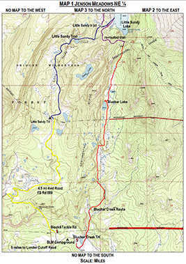
Example route map
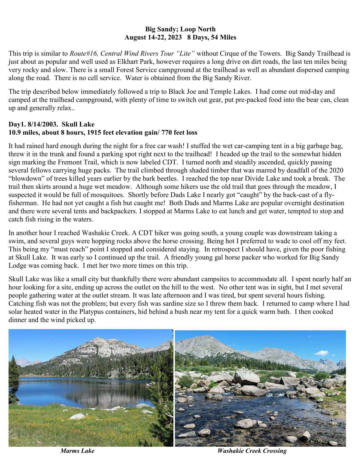
TRIP REPORT
Contact Us
Nancy Pallister
4904 Sir Henry Court
Fair Oaks, CA 95628
916-835-5991
backpackwindrivers@mcreynoldscpa.com